
In the very background you can see the outline of the volcanoes, Pavlov and the sisters. This sight is our indicator of what the day is going to be like and what you need to do....get outside and play or climb on something!!
The view below from my little porch (or stoop) reveals Battle Mountain and today, my friend Denise and I decided we were going to hike it, from one end to the other. We packed, dressed and headed out after church for a hike we had been dreaming of all summer. I parked my 4 wheeler at the north end and we took her truck to the south end near the airport and began our hike with a smile and a prayer.
 We couldn't have picked a better day. Sunny skies, light breeze and plenty of hours left in the day. We were determined to enjoy it and take our time because who knows what the weather will bring next.
 We stopped numerous times to enjoy the photo opportunities as well as the berries along the way. These elder berries are poisonous if eaten raw, but they sure made a colorful addition to the scenery.

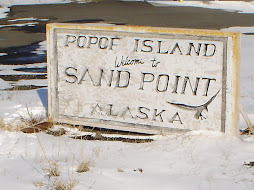
Here is my favorite color again...Aleutian blue...anyone who has seen it personally knows what I am talking about. The camera doesn't even capture the clarity and brilliance of it, but somehow I have to be able to share this with you. All the little white specks are the homes of Sand Point about 2 1/2 miles away.

 The view across the roof of Battle Mountain looks like it is a hop, skip and a jump away, but here distance is deceiving. You could easily have fit 4 football fields up here. Traffic wouldn't be problem, no one could get here unless they walked and were dumped off a helicopter. It took over an hour picking our way among the uneven ground and holes to get to the base of the bulge in the background.
 Once we peaked the bulge it was down hill all the way, literally. The skinny little bump to the left is Danger Point but it doesn't feel skinny when your hiking up it.
 The ground up here is tundra, rutted and these humps are sometimes 12-18 inches tall, the ground is like walking on a sponge and works your quads like no pilates I've been to.
 And here we have what??? Mile marker #1? #2? What is this?! They are posts to mark the route for other hikers to make the ascent up the north side and were put here by Denise's aunt and uncle several years ago. When you are at the base looking up, it is hard to judge what is the best route, least steep, but safest passage, but thanks to these former trekkers, we have a marked trail to follow.
  And then at the bottom, it is nice to look back to see how far you've come and this view isn't even a 1/10th of what we traveled today. It took us nearly five hours to get to the peak and less than an hour to make the descent. Of course we had our snacks and took plenty of photos along the way.
We rested at the bottom on a ledge and as if on cue, a pair of eagles came out and soared over our heads reminding us how majestic they were and what a perfect day we had been given.
This month made up for our bad weather in July, and I will continually look for opportunities to get outside and I am looking around now wondering what I can climb on next?!


